← Back to KANOA

YOUR COASTAL NOTEBOOK

The Caribbean coast.
Seen from the sea.

From quiet coves below Mount Pelée to the villages of the south: six beautiful reasons to head out with KANOA.

06places to exploreCase-Pilotereference departure point15 knotsestimated cruising speed

CHOOSE YOUR HORIZON

Your next stop,
right here.

Select a stop to find it on the map.

Anse Couleuvre · 14.8420, −61.2192Open in Maps ↗

Coordinates are approximate visitor landmarks, not navigation or anchoring waypoints. Navigate using nautical charts and the departure briefing.

SIX STOPS, A THOUSAND MEMORIES

The journey is
part of the magic.

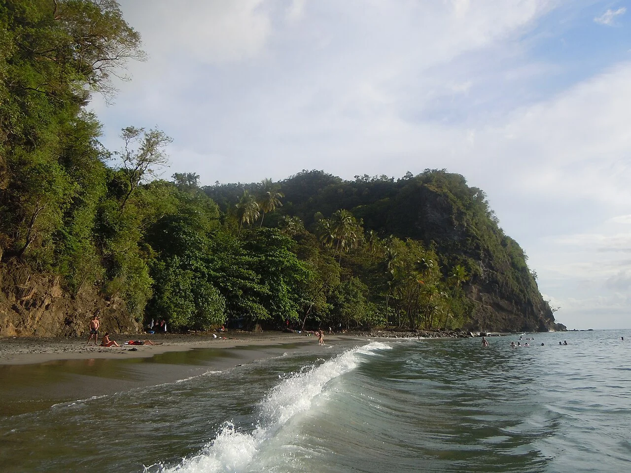
Anse Couleuvre01© Patrice78500 · CC BY-SA 4.0
CARIBBEAN NORTH65–80 min

Anse Couleuvre

Below the cliffs of Le Prêcheur, a dark sand beach nestles in lush vegetation. Head north for wild shores and dramatic scenery.

Visit in calm seas: currents and swell can make swimming or landing unsuitable.

14.8420° N · 61.2192° W · ≈ 15 nautical miles
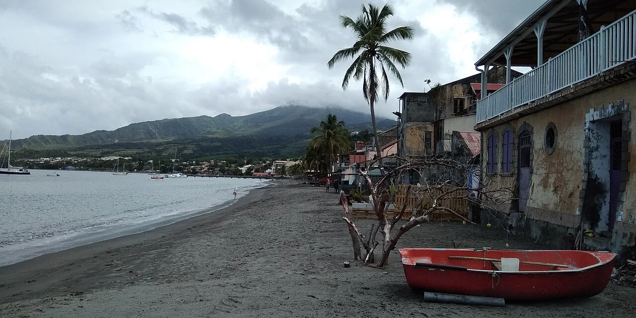
Saint-Pierre02© Patrice78500 · CC BY-SA 4.0
CARIBBEAN NORTH40–50 min

Saint-Pierre

A bay beneath Mount Pelée, a town shaped by the 1902 eruption. The waterfront and ruins invite a cultural stop.

Arrange landing and visits with your skipper.

14.7413° N · 61.1764° W · ≈ 8 nautical miles
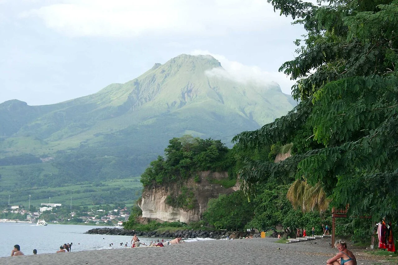
Le Carbet · Anse Turin03© Auteur non renseigné ; téléversement Jurassi · Public domain
CARIBBEAN NORTH35–45 min

Le Carbet · Anse Turin

Grey sand, traditional fishing boats and Mount Pelée: Le Carbet reveals another side of the island. Anse Turin opens onto a lovely view towards Saint-Pierre.

The landmark is not an anchoring permit: choose an authorised stopping place during the briefing.

14.7279° N · 61.1804° W · ≈ 7 nautical miles
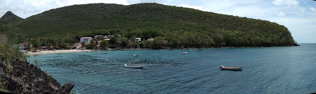
Anse Dufour & Anse Noire04© Patrice78500 · CC BY-SA 4.0
CARIBBEAN SOUTH40–50 min

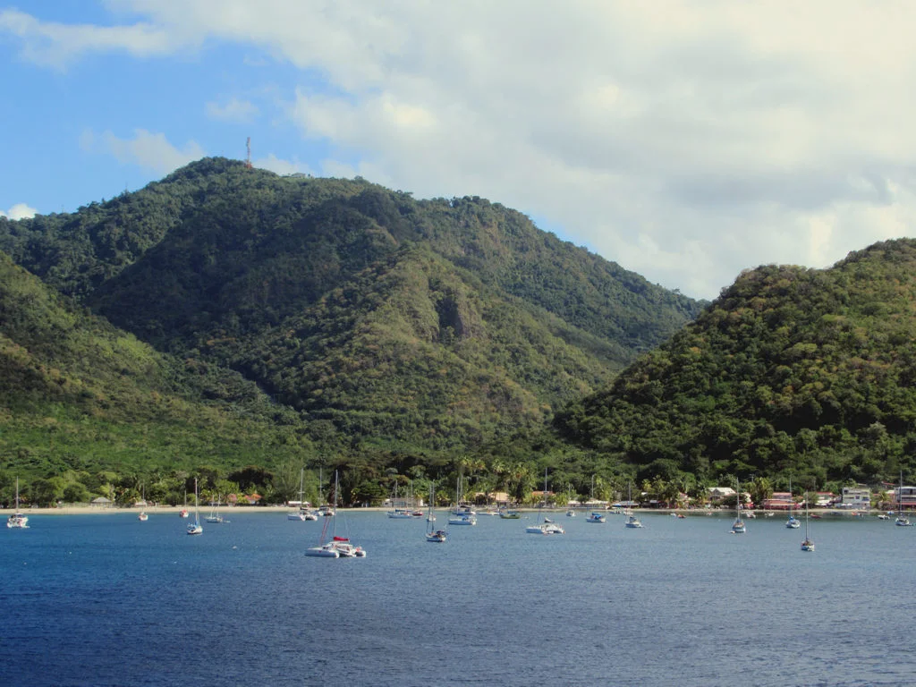
Anse Dufour & Anse Noire

Two neighbouring coves, two different moods: pale sand at Dufour and volcanic sand at Anse Noire. Pause to enjoy the sea and watch wildlife from a distance.

Respect swimming zones, markers and the turtles’ space.

14.5256° N · 61.0900° W · ≈ 8 nautical miles
Grande Anse d’Arlet05© David Stanley from Nanaimo, Canada · CC BY 2.0
CARIBBEAN SOUTH45–60 min

Grande Anse d’Arlet

A broad bay framed by green hills, sailing boats and waterfront terraces. A friendly stop to slow down and enjoy lunch by the sea.

Use a buoy or anchoring area according to local rules, availability and KANOA’s instructions.

14.5053° N · 61.0842° W · ≈ 10 nautical miles
Le bourg des Anses-d’Arlet06© Patrice78500 · CC BY-SA 4.0
CARIBBEAN SOUTH50–65 min

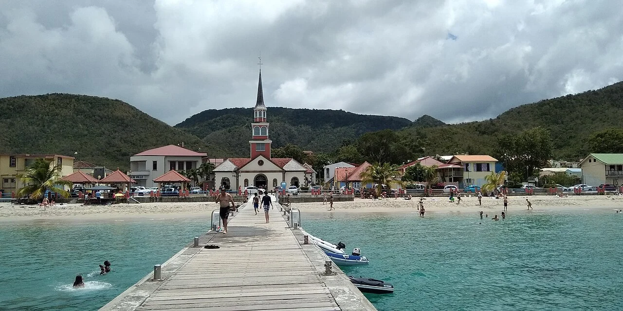
Le bourg des Anses-d’Arlet

The jetty facing Saint-Henri church is one of Martinique’s classic views. From the bay, discover the fishing village, its beach and surrounding hills.

The pin marks a place to visit, not an approach route or berth.

14.4902° N · 61.0809° W · ≈ 11 nautical miles
How are travel times estimated?

Estimated one-way travel from Case-Pilote at 15 knots (about 28 km/h), following sea routes around headlands and allowing for departure and approach. Stops are excluded. Weather, sea conditions, load, route and speed limits affect actual times. Confirm with KANOA during your briefing. Ask for a separate estimate if leaving from Fort-de-France.

WE SHARE THE SEA

Explore with care.

01

A well-prepared departure

Check the marine forecast, fuel, equipment and return time during your briefing.

02

Protect the seabed

Use authorised moorings. Never anchor on coral or seagrass.

03

Sightseeing and fishing differ

A beautiful stop may be closed to fishing. Check restricted areas before putting a line in the water.

Read the fishing guide

KANOA · MARTINIQUE

Ready to head out?

Plan my adventure
Book my adventure
MIYO at anchor